For landscape architecture firms

Collect feedback directly on your site plan.

Upload your plan or rendering. Residents pin comments, compare concepts, and draw routes directly on it. Results return sorted, visualised, and ready for your report.

We build a demo on it and send you the live link.

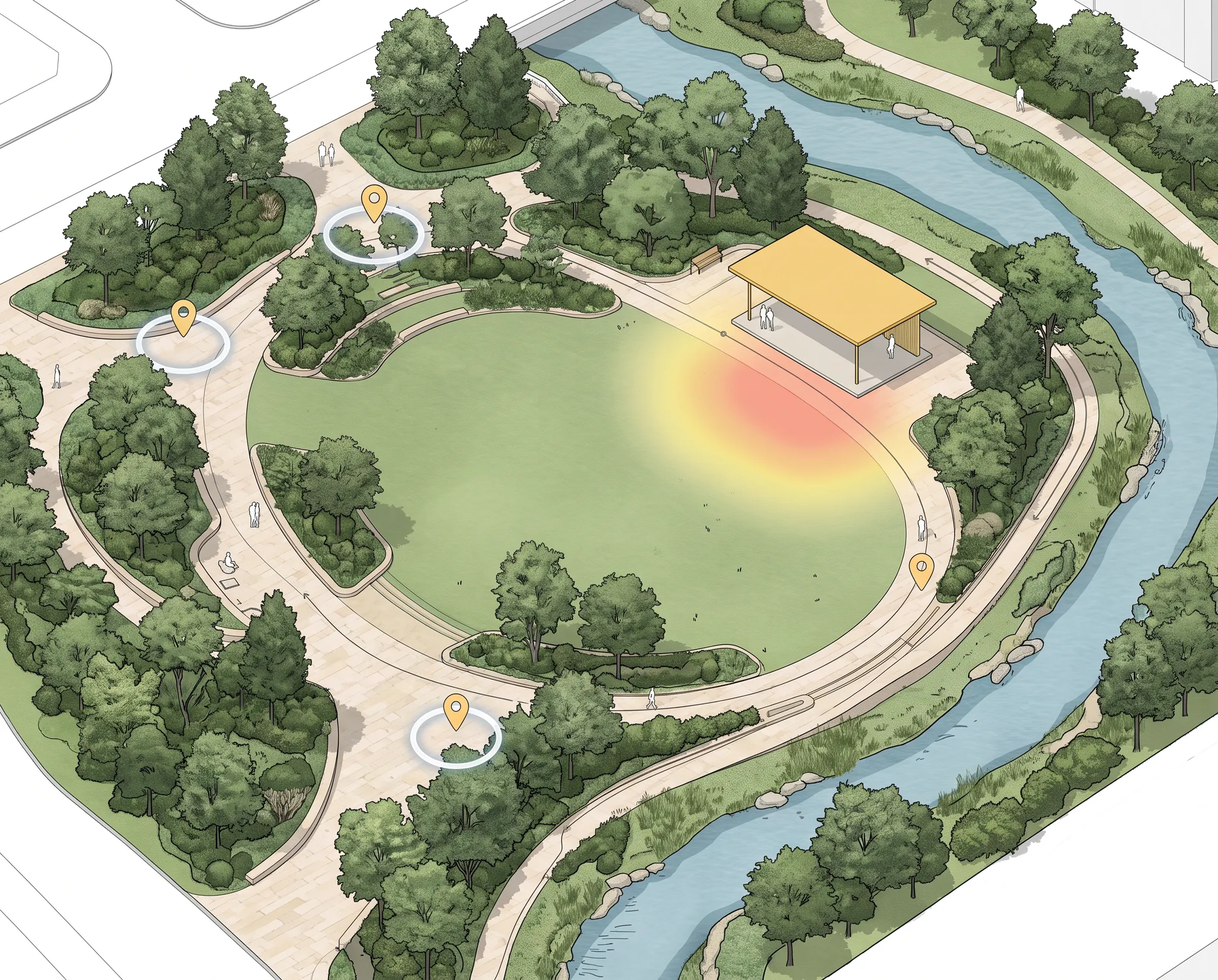
Rendered creekside park plan with spatial feedback pins, response-location rings, and a heat-map overlay

Where the hours go

Three things still done by hand on a park project.

Place-based comments

Today

“By the playground” is located by guesswork, then plotted in Illustrator or GIS hundreds of times per project.

With Senf

Every comment lands as a pin on the site plan. Heat maps reveal clusters; GeoJSON and SVG exports move straight into GIS and presentation boards.


Visual preference

Today

Print the boards, hand out the dots, and count them by hand. Online responses live separately in SurveyMonkey, disconnected from the plan.

With Senf

Upload concept images for residents to pick, rank, or rate. Use the same question on-site via QR code and online, with results tallied as they arrive.

The proposal

Today

Two pages of methodology and a process diagram that looks the same as every other shortlisted proposal.

With Senf

Put a working survey on the client’s study area directly into the submission. For Carroll Creek Park, the panel opened it during the interview.

Brian Reetz, Principal at Design CollectiveDesign Collective

In the past we would calculate 60 hours of post-production to go through the survey information. With Senf it's just done.

Brian Reetz · Principal, Design Collective

One connected workflow

From site plan to design-ready evidence.

Keep the plan, the public input, and the outputs in one project instead of rebuilding the work between tools.

Start with the source file

Use the plan you already have.

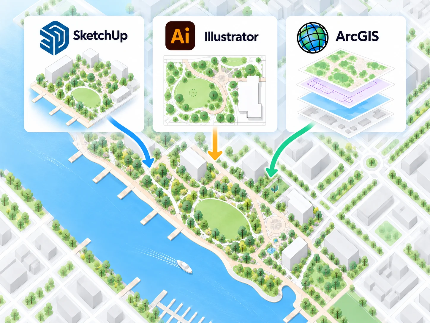
Upload an illustrative plan from Illustrator, a rendering from SketchUp, or layers from ArcGIS. Senf georeferences it over the map, so residents respond on the same plan the client has already seen—without anything being redrawn for the survey.

Illustrator, SketchUp, and ArcGIS files feeding into a georeferenced landscape architecture site plan

Collect input in context

Pins on the plan, in their words.

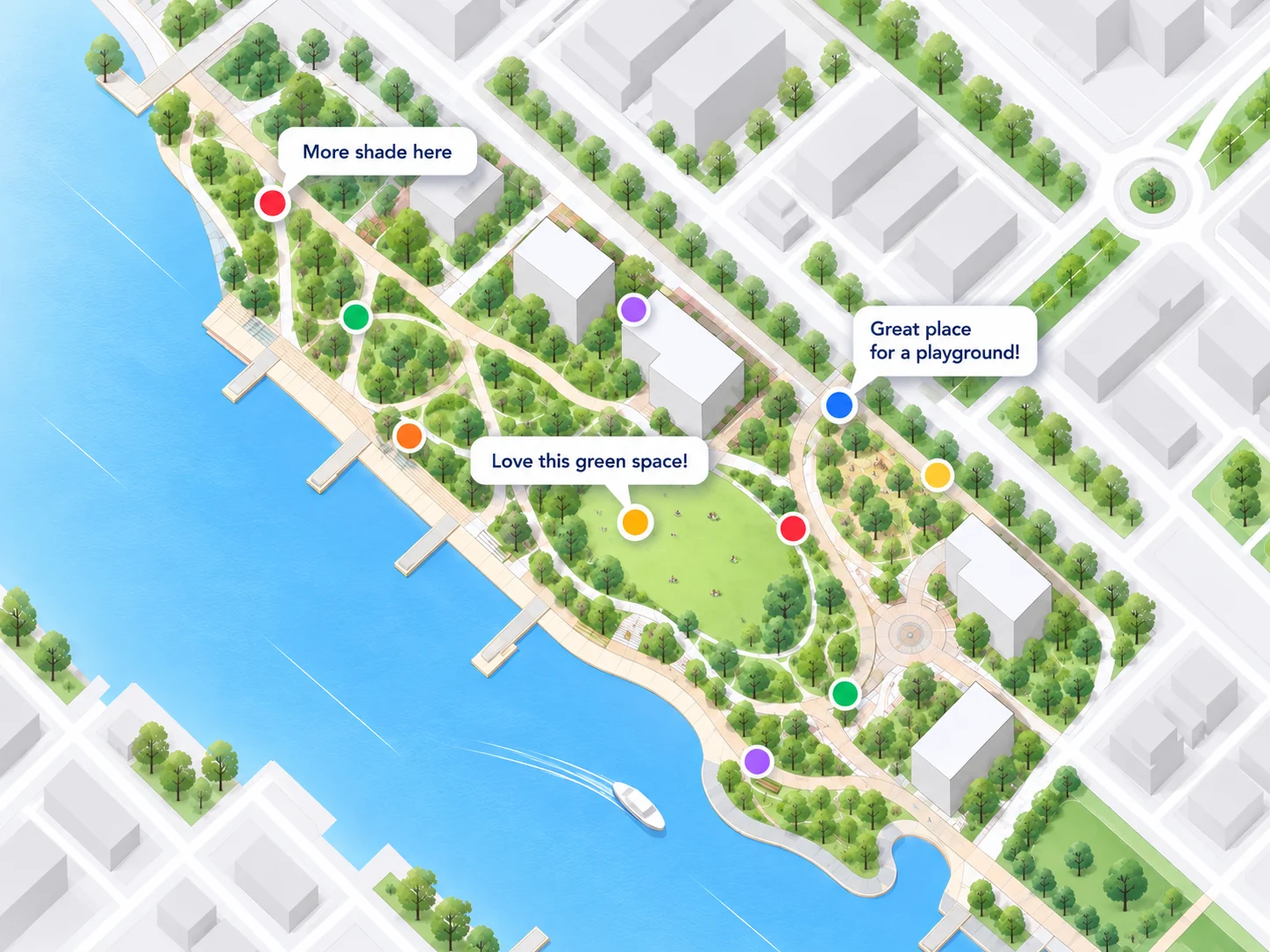
Residents zoom into the plan, pin the exact place where shade runs out, a crossing feels unsafe, or a bench is missing, and explain why. Add image choices, drawn routes, marked areas, rankings, and open text without splitting the project across separate tools.

Resident comments and feedback pins placed directly on a landscape architecture site plan

Turn responses into evidence

Read it on the plan. Export it for the boards.

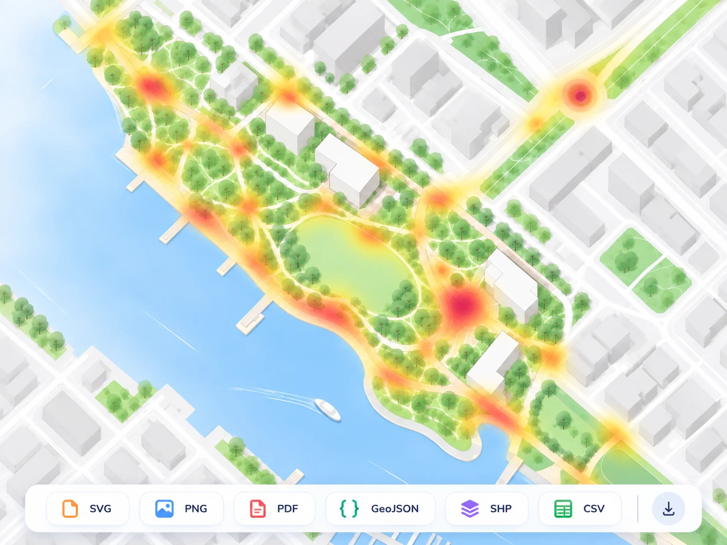
Heat maps show where comments cluster, while open text is categorized as responses arrive. Export charts as SVG or PNG, spatial input as GeoJSON or a shapefile, and the full dataset as Excel. Spatial input can also flow into ArcGIS Online as it arrives.

“You could immediately see where most comments clustered, then zoom in and read what people were saying directly in the dashboard.”

Brian Reetz · Principal, Design Collective
Heat map over a landscape architecture site plan with design and spatial data export formats
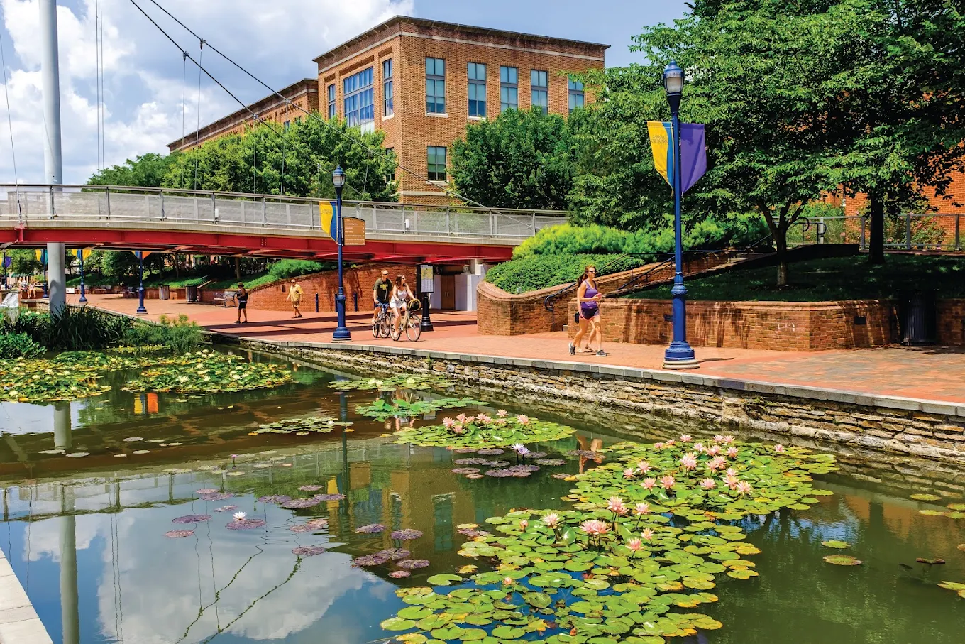
Carroll Creek Park in Downtown Frederick, Maryland, with pedestrians beside the canal, flowering water lilies, a bridge and brick buildings.

Landscape architecture case study

From map-based input to design direction

For the Carroll Creek Park refresh, Design Collective used Senf to understand where residents encountered problems and which planting and shade concepts they preferred—then carried that evidence into the design boards.

2,201

started

1,436

completed

65.2%

completion

Built for the full project mix

The projects landscape architecture firms run with Senf.

Use the same plan-first workflow across site scales, project phases, and public-realm questions.

Park & recreation redesign

Test ideas for play, shade, planting, circulation, and amenities directly on the proposed plan.

Campus landscape planning

Collect place-specific input across quads, paths, entrances, and phased campus improvements.

Plaza & public realm design

Compare materials, seating, programming, and public-realm concepts with residents and stakeholders.

Trail & greenway networks

Map missing connections, safety concerns, desired routes, and priorities along linear corridors.

Streetscape & urban greening

Locate comfort, access, planting, and crossing issues block by block before design decisions are fixed.

Climate resilience plans

Ground resilience strategies in local experience of heat, flooding, shade, and everyday use.

A demo built on your work

Send a site plan or an RFP. We'll build the demo on it.

Send the plan or rendering from a project you're running, or the RFP from one you're pursuing. We put the plan on the map, draft the survey and website around the scope and send you the live link. You decide afterwards whether it's worth a conversation.

By using this form, you agree to the privacy policy.

Pascal Fuhr, CEO of Senf

Contact our CEO Pascal directly via mail - pascal.fuhr@senf.app