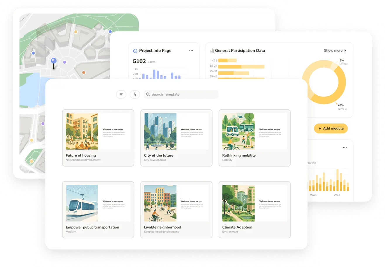
BIM & Infrastructure
BIM-based participation for building and infrastructure projects
Senf makes BIM planning states understandable for stakeholders, collects feedback with spatial context, and supports your team with analysis and dialogue — whether an infrastructure corridor or an urban district.

The problem
BIM has arrived in planning. In participation, often not yet.
Building and infrastructure projects have long been planned digitally. But for communicating with the public, municipalities, and other stakeholders, the models are often left out.
BIM models are too big for participation
Large models load slowly, are complex to operate, and often only work on high-performance devices — hardly practical for public participation.
Feedback scatters across many channels
Project website, contact form, email, letter, and on-site appointments rarely come together cleanly.
Analysis means a lot of manual work
Statements have to be collected, categorized, assigned to the right responsibilities, and answers coordinated.
The solution
From BIM model to participation people understand
With Senf, a complex planning model becomes an understandable participation format: fast to load, simple to use, and usable on every device. Feedback is created directly in its spatial context and processed in a structured way by your team.
01
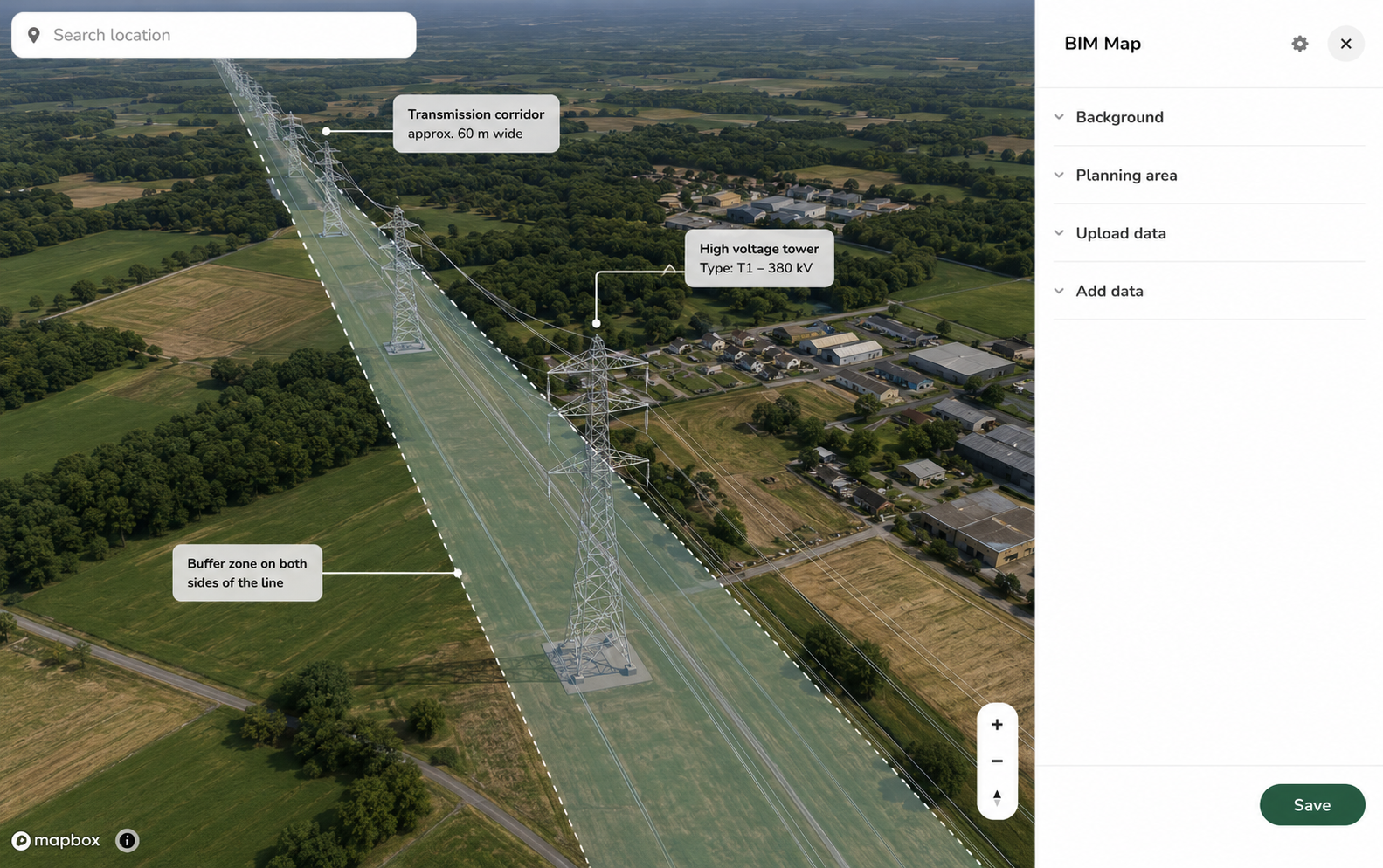
Make BIM models easy to access
Senf makes large BIM models usable for participation — no specialist software, no high-performance hardware, and even on a smartphone. Existing BIM data can be embedded, spatially located, and published as an understandable planning state.
02
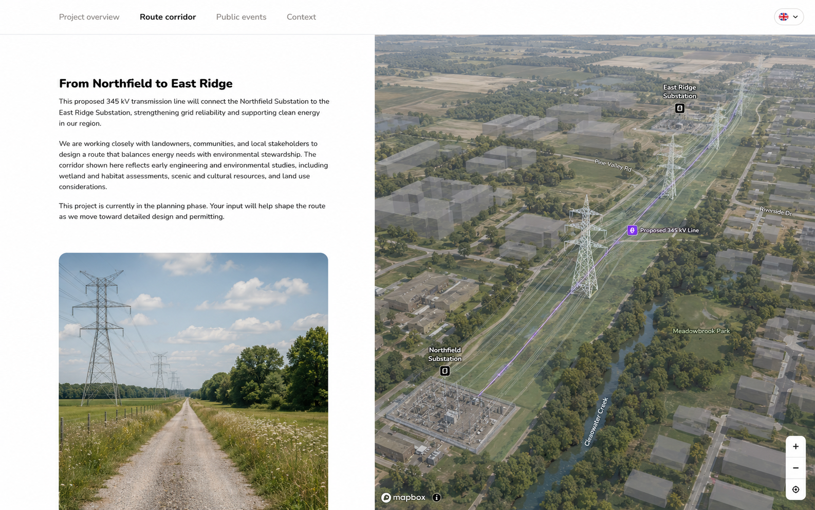
Explain planning content clearly
Complex projects are prepared so that non-experts can follow them too: with 3D views, maps, sections, info pages, and accompanying explanations.
03
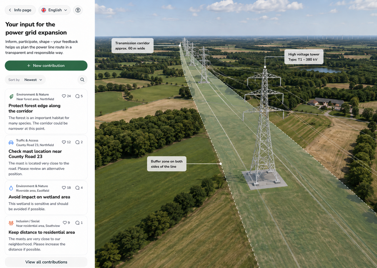
Collect feedback right where it belongs
Notes, questions, and comments are created where they belong: on the model, on the map, along a route, or within a defined area. The spatial context stays intact from the very start.
04
Analyze feedback as a team and feed it back
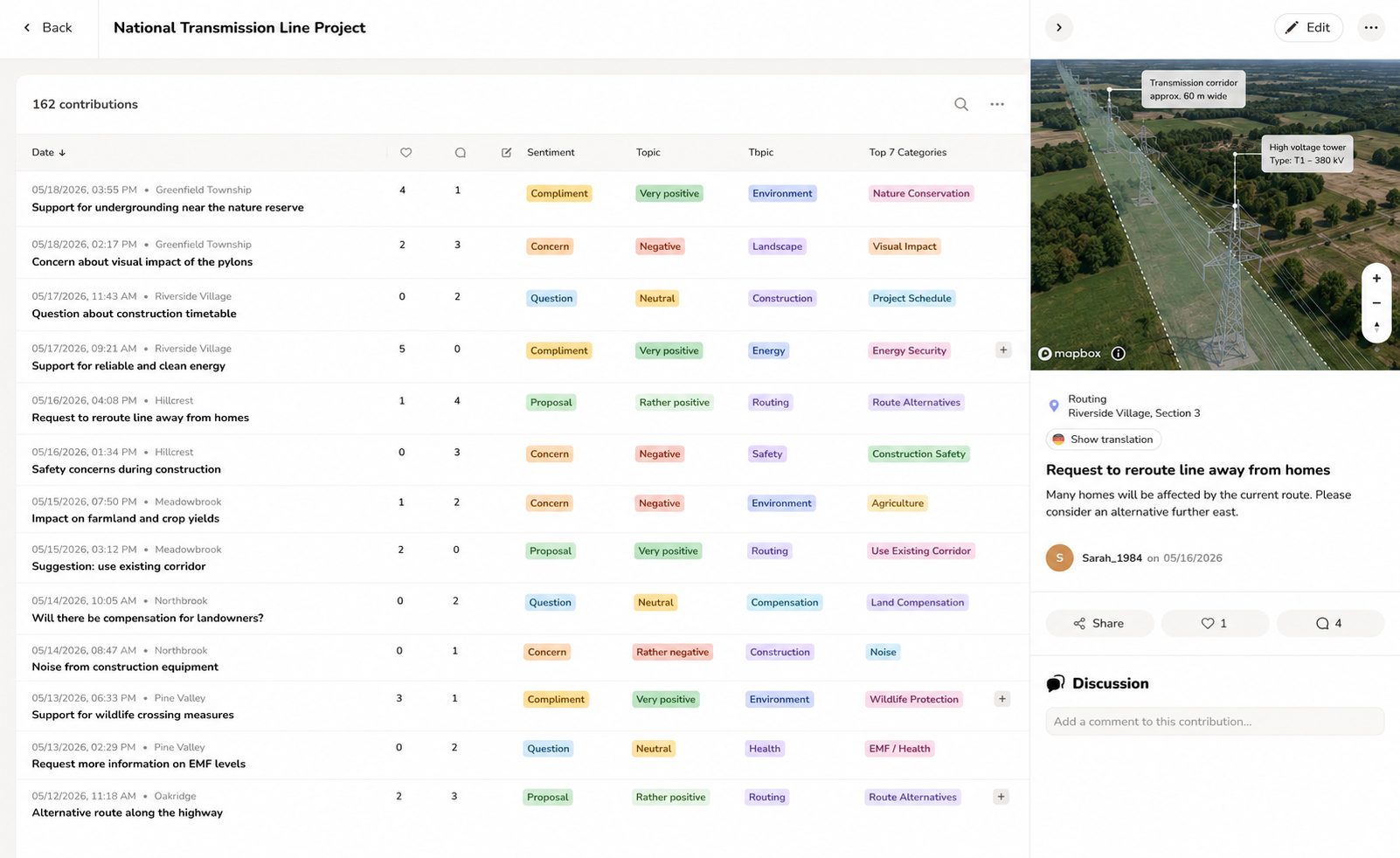
All contributions come together in the dashboard. The team can filter and cluster feedback, assign responsibilities, prepare answers, and feed the relevant input back into planning. Located comments can be exported as BCF and opened directly in your BIM authoring tools, so feedback lands right back on the model.
Who it's for
For teams on building and infrastructure projects
Project owners
Document participation in a verifiable way, bundle project communication, and simplify internal processing.
Planning firms
Make BIM models directly usable for communication and participation — without creating new visualizations every time.
Communication agencies
Set up participation formats independently, embed them into existing project websites, and run them for the right audience.
Municipalities & developers
Develop district and building projects transparently, document participation in a verifiable way, and build local support.
Across all project types
For projects that have to be explained and agreed on
Senf is especially suited where planning states need explanation, many stakeholders are involved, and feedback has to be documented cleanly.

Rail
New build, upgrades, stations, tunnels, junctions.

Road
Trunk roads, bypasses, bridges, intersections.

Power line
Grid expansion, overhead lines, underground cable, substations.

Buildings & districts
Urban districts, conversion sites, campuses, large building projects.
FAQ
Frequently asked questions
Senf doesn't replace your website. The participation can be embedded via iFrame and complements your existing information offering.
Experience participation directly on the 3D model
We'll show you how an infrastructure project is built in Senf — from fast model access through dialogue maps to analysis in the dashboard.