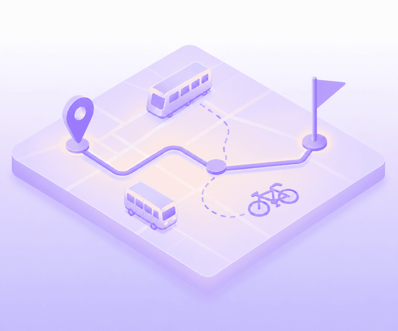
Transportation projects need more than a survey
Collect route-level public input, analyze thousands of comments in hours, and export directly into ArcGIS — all from one platform built for how your projects actually work
Transportation projects need more than a survey
Collect route-level public input, analyze thousands of comments in hours, and export directly into ArcGIS — all from one platform built for how your projects actually work
Transportation projects need more than a survey
Collect route-level public input, analyze thousands of comments in hours, and export directly into ArcGIS — all from one platform built for how your projects actually work
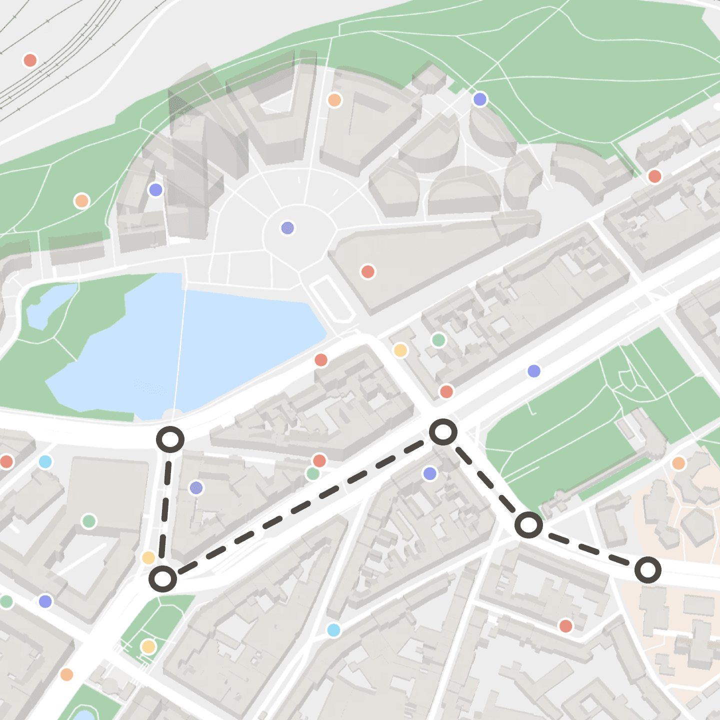
Spatial input, captured where it happens.
Participants engage directly on your project map - flagging unsafe intersections, drawing preferred routes, marking underserved stops. Every contribution is georeferenced at the moment of collection. No text-only surveys. No manual geocoding after the fact.
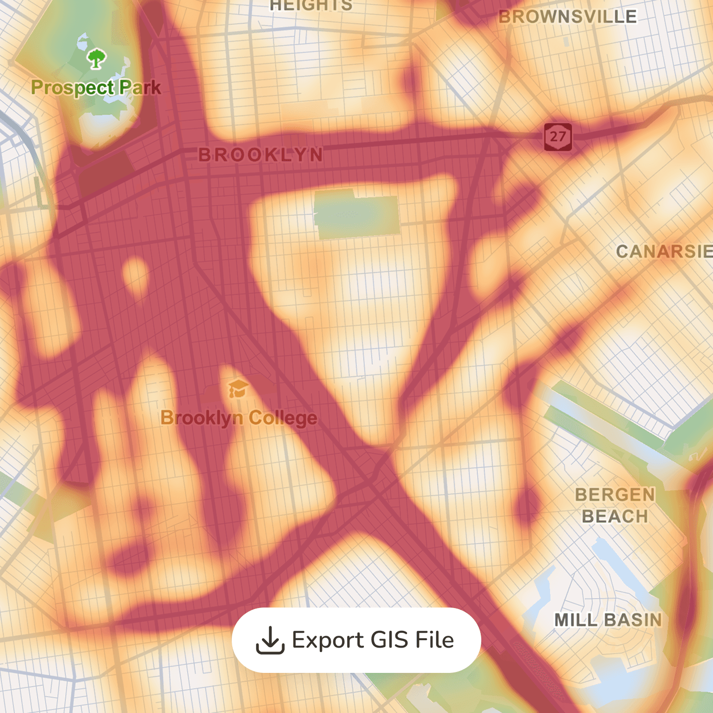
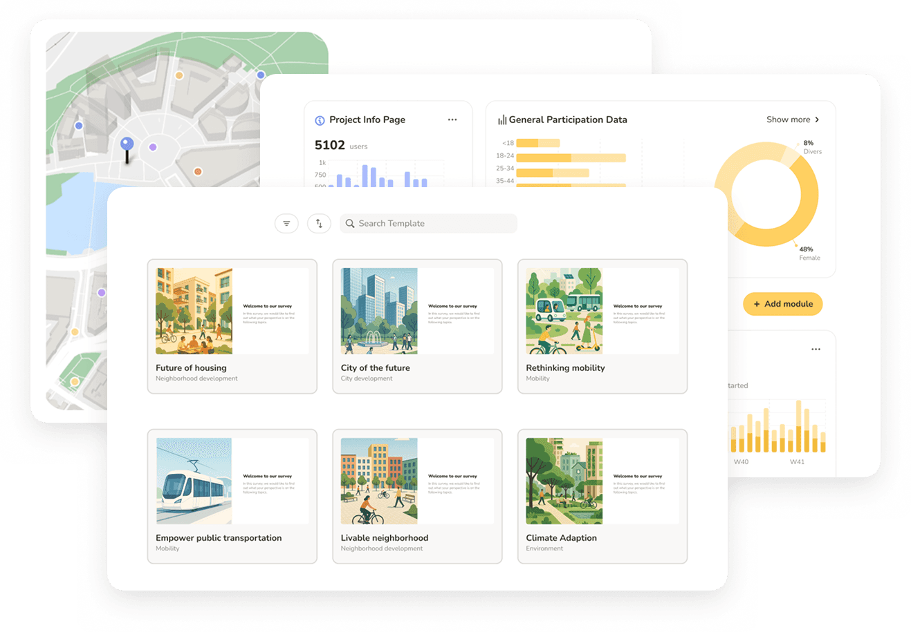
Heatmaps in Senf. Export directly in ArcGIS.
See exactly which segments, intersections, and stops generate the most feedback — live, as responses come in. When the engagement closes, export the full dataset as GeoJSON or Shapefile and bring it straight into ArcGIS or QGIS. No coordinate translation. No data wrangling.
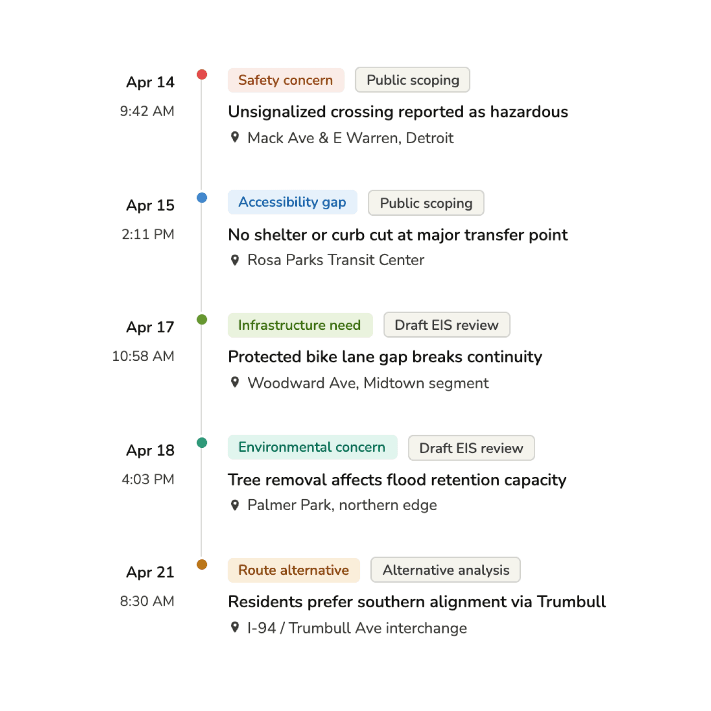
NEPA documentation, built as you go.
Every submission is timestamped, attributed, and tied to a project phase from the moment it's collected. When a federal agency or state DOT asks for process documentation, you're not reconstructing it from Zoom recordings and Google Form exports. You're pulling it from a system built to produce it.
Spatial input, captured where it happens.
Participants engage directly on your project map - flagging unsafe intersections, drawing preferred routes, marking underserved stops. Every contribution is georeferenced at the moment of collection. No text-only surveys. No manual geocoding after the fact.
Heatmaps in Senf. Export directly in ArcGIS.
See exactly which segments, intersections, and stops generate the most feedback — live, as responses come in. When the engagement closes, export the full dataset as GeoJSON or Shapefile and bring it straight into ArcGIS or QGIS. No coordinate translation. No data wrangling.
NEPA documentation, built as you go.
Every submission is timestamped, attributed, and tied to a project phase from the moment it's collected. When a federal agency or state DOT asks for process documentation, you're not reconstructing it from Zoom recordings and Google Form exports. You're pulling it from a system built to produce it.
USE CASES
The projects transportation planning firms run with Senf.
Transportation Corridor Studies
Transit & BRT Planning
Cycling & Pedestrian Infrastructure
Mixed-Use & TOD Outreach
Safe Streets & Active Transportation
Climate Resilience & Mobility Plans
USE CASES
The projects transportation planning firms run with Senf.
Transportation Corridor Studies
Transit & BRT Planning
Cycling & Pedestrian Infrastructure
Mixed-Use & TOD Outreach
Safe Streets & Active Transportation
Climate Resilience & Mobility Plans
USE CASES
The projects transportation planning firms run with Senf.
Transportation Corridor Studies
Transit & BRT Planning
Cycling & Pedestrian Infrastructure
Mixed-Use & TOD Outreach
Safe Streets & Active Transportation
Climate Resilience & Mobility Plans
See Senf in action
• Walk through a project scenario relevant to you
• See setup, engagement, and analysis end to end
• Discuss pricing based on your project volume
See Senf in action
• Walk through a project scenario relevant to you
• See setup, engagement, and analysis end to end
• Discuss pricing based on your project volume
See Senf in action
• Walk through a project scenario relevant to you
• See setup, engagement, and analysis end to end
• Discuss pricing based on your project volume