Community engagement for Safe Streets & SS4A action plans
Running the public engagement a Safety Action Plan requires — and documenting it for the grant

The Safe Streets and Roads for All (SS4A) program funds the Safety Action Plans that communities need before they can compete for implementation dollars. Public engagement is not a side activity in that work — it is one of the components a Comprehensive Safety Action Plan is expected to include, and equitable engagement is woven through the program's priorities. For the transportation and planning firms running these plans, engagement is where local knowledge about dangerous locations enters the analysis and where the grant's equity expectations are either met or missed. This guide covers what SS4A engagement needs to accomplish, why safety lends itself to map-based input, and how to run a process that produces a record the grant reviewer can trust.
Engagement is part of the plan, not an add-on
SS4A is built around a small set of action-plan components, and engagement and collaboration is one of them. A Safety Action Plan is expected to show robust engagement with the public and relevant stakeholders, including the people most affected by traffic safety problems. The program pairs that with a strong equity focus: outreach is supposed to reach underserved communities, which are frequently the same neighborhoods carrying the highest crash burden. So the engagement work has two jobs at once — gather the local knowledge that sharpens the safety analysis, and demonstrate that the communities bearing the risk were genuinely involved.
That dual mandate is what makes SS4A engagement different from a routine comment period. A plan that engaged only the residents who already attend meetings has a credibility problem with the very communities the program prioritizes — and a documentation problem when the grant is reviewed.
Why traffic safety is a natural fit for map-based input
Crash data tells you where people have been hurt. It does not tell you where people feel unsafe but have so far been lucky — the near-miss intersection, the crossing kids avoid, the stretch with no lighting. That lived knowledge is exactly what residents can contribute, and it is inherently spatial. Asking people to describe a dangerous location in a text box loses most of the value; asking them to drop a pin on the spot and say what makes it unsafe captures it.
Map-based engagement turns that input into something the safety analysis can actually use. Resident-reported concerns can be laid against the crash history to confirm hotspots, surface locations the data missed, and build the case for specific countermeasures. The map is also the most legible way to show a grant reviewer that input came from across the jurisdiction rather than one vocal corner of it.
What the engagement record has to demonstrate
Reach into the priority communities
Given the program's equity focus, the record should show deliberate outreach to underserved and high-injury communities: materials in the languages those residents speak, channels that do not depend on attending a meeting, and partnership with organizations already embedded in those neighborhoods. Who you reached matters as much as how many.
Input that connects to the safety analysis
Engagement should not sit in its own appendix disconnected from the rest of the plan. The strongest plans show resident input shaping the identification of high-risk locations and the selection of projects. That requires capturing input in a form the analysis can absorb — located, categorized, and comparable against the crash data.
A defensible, retrievable account
Federal grant work invites scrutiny. The engagement summary needs to hold up: how many people participated, where they were, what they said, and how it informed the plan. Engagement scattered across a survey tool, social posts, paper comment cards, and in-person events is difficult to consolidate into one credible account after the fact.
How to run SS4A engagement that holds up
Plan outreach around the equity priority
Identify the underserved and high-injury communities first, then design outreach to reach them specifically — language access, trusted community partners, and low-barrier digital participation that works from a phone. A map-based platform lowers the cost of taking part, which is exactly what is needed in neighborhoods that have historically been under-engaged.
Let residents map the danger
Make the core question spatial: where do you feel unsafe, and why? Pinned, categorized safety concerns are immediately useful — they can be clustered, compared against crash records, and translated into candidate locations and countermeasures. This is where community input stops being anecdotal and starts strengthening the analysis.
Synthesize as input arrives
Safety engagement generates a lot of open-text detail. Senf's native AI analysis groups those responses into themes as they come in, so the project team is working from emerging patterns rather than a backlog of raw comments at the deadline. The engineering judgment about what the input means stays with the firm; the manual sorting that usually delays the synthesis does not.
Build the grant-ready record continuously
Because participation, locations, and themes live in one place, the engagement summary for the Safety Action Plan is a product of the work rather than a last-minute reconstruction. When a reviewer asks how the public shaped the plan, the answer is already documented and mapped.
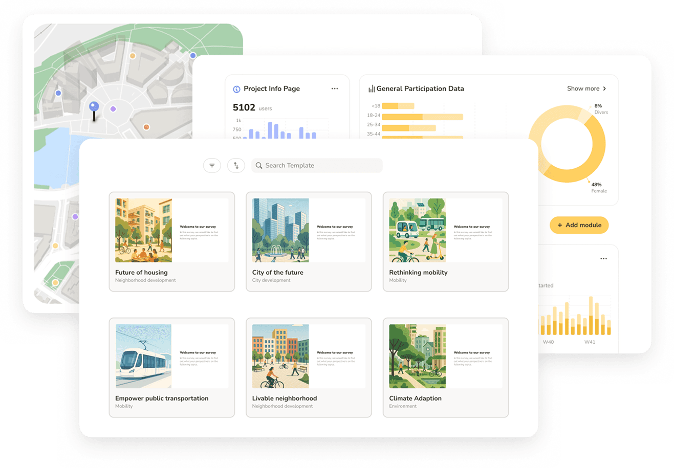
Where Senf fits
Senf is an AI-native community engagement platform built for private-sector planning, design, and engineering consultancies. For an SS4A Safety Action Plan, that means one platform to capture where residents feel unsafe on a map, reach priority communities in multiple languages, analyze open-text safety concerns into themes natively, and produce a client-ready engagement record — from outreach through reporting. It does not replace the firm's safety analysis; it makes the community's contribution to that analysis usable and the engagement record defensible.
If your firm is preparing an SS4A Safety Action Plan and wants the engagement component to strengthen both the analysis and the grant narrative, the demo below walks through what that looks like on a real project.
See Senf in action
• Walk through an SS4A safety-engagement scenario
• See map-based safety input, equity outreach, and reporting end to end
• Discuss pricing based on your project volume
See Senf in action
• Walk through an SS4A safety-engagement scenario
• See map-based safety input, equity outreach, and reporting end to end
• Discuss pricing based on your project volume
See Senf in action
• Walk through an SS4A safety-engagement scenario
• See map-based safety input, equity outreach, and reporting end to end
• Discuss pricing based on your project volume